
Site Survey
by
Graham Perry
A Summary Description of Latton Canal Basin and the Associated Physical Structures on the Adjacent Section of the North Wilts Canal
Introduction
The North Wilts Canal opened in 1819 connecting the Wilts & Berks Canal at Swindon to the Thames & Severn Canal at Latton (Dalby 2000 p61). Between Cricklade and the junction at Latton the canal crosses the flood plain of the upper Thames. Generally flat, this area floods to a greater or lesser degree every winter. Additionally it is crossed by two arms of the River Churn as well as the Thames and a number of minor drains. Consequently the canal in this area was built with a total four aqueducts.
The North Wilts Canal was built to accommodate narrowboats, typically 72 feet long with a Beam of 6 feet 10 inches (22 x 2.1m). However, the Thames & Severn Canal, with its direct connection to the river Thames, was built for shorter and wider craft which were in use on the river. Consequently, at the junction of the two there was a need for a transhipment facility which was provided by the Latton Canal Basin.
Although the two canals were at a similar level there were concerns that water could be lost in either direction in the event of a breach. In his book “The Wilts and Berks Canal”, Dalby reports that the finished canal was level for 3.5 miles with “only stop gates to protect the Thames and Severn water” (Dalby 2000 p 47). However he also reports that “The regulating lock , however, was not built until 1826..” (Dalby 2000 p46).
Next to the lock was also constructed a Lock Keeper’s cottage.
Descriptions
1. The Northern Churn Aqueduct
OS grid reference 4087119536
Wiltshire and Swindon Historic Environment Record record number MWI76164
The WSHER states “An aqueduct taking the North Wilts Canal over the River Churn now demolished”.
Although described as a branch of the river Churn, the elevated level of the water course crossed by the canal would suggest that it is a mill leat supplying a mill to the East of the site. Due to the level of the water in this water course compared to the level that would have been in the canal it is apparent that the aqueduct would have been in the form of an invert. In suitable conditions the base of this structure can be seen below the water. Photographs taken before the aqueduct was dismantled, show it to have been a stone built structure. This agrees with the historic record which also shows that it was built by the Thames and Severn Canal company. (Dalby 2000 p58)
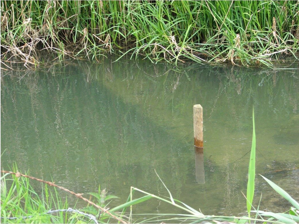
Photograph 1. The base of the Northern Churn Aqueduct 17th May 2008 GP
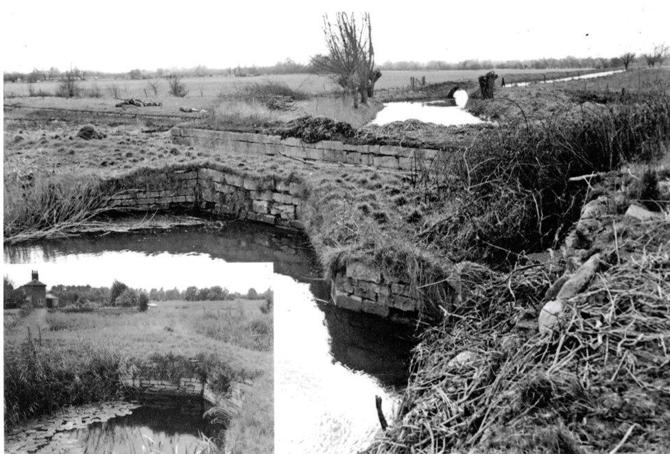
Photograph 2. Old photographs of the Northern Churn Aqueduct. Anon
2. Latton Canal Basin
OS Grid Reference 4086919534
Wiltshire and Swindon Historic Environment Record record number MWI76165
The WSHER states “A canal basin on the North Wilts Canal, now being restored”
This substantial stone built structure was also built by the Thames and Severn Canal Company. (Dalby 2000 p58).
The interior dimensions of the basin are 61 by 18.3m (200 by 60 feet). Apart from one corner which has been infilled, the base is 1.7m below the cap stones. In each of the short sides are the entrances to connect with the canals.
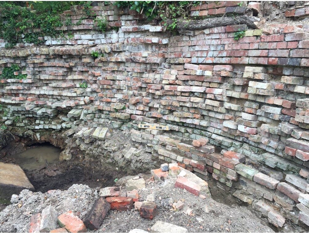
At the South East corner the structure shows evidence for a sluice which sealed a drainage tunnel. The tunnel still exists and is in good condition. This end of the tunnel is stone lined. The opposite end is brick built.
Restoration projects have removed trees growing from the walls of the basin and repaired the damaged thus caused. They have also replaced missing cap stones with cast concrete replicas.
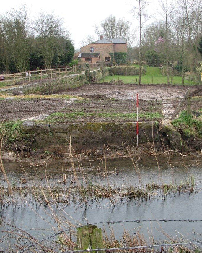
Photograph 3. A view of the site of the Northern Churn Aqueduct looking into the Canal Basin from the public footpath on the towpath of the Thames & Severn Canal. The Lock Cottage is in the background. GP
3. The Lock
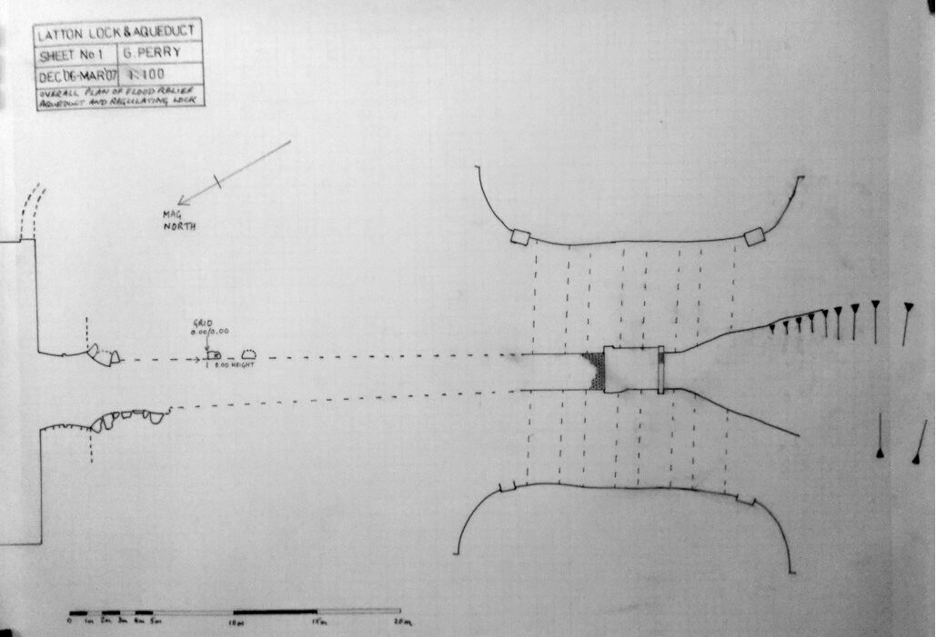
Figure 1. Plan of the “Lock”. The end of the Basin is on the left and the Flood Relief Aqueduct on the right. GP
4. The Lock Cottage
OS Grid Reference 4086919530
This does not have an entry in the WSHER.
The original Lock Cottage has been extended and modernised and is currently a private residence. Part of the Basin, the Lock and a small part of the Flood Relief Aqueduct are part of the grounds to the Cottage. No recording has yet been carried out of the cottage.
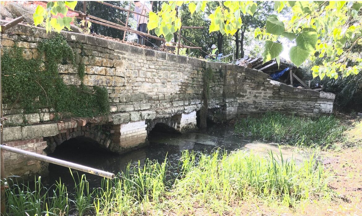
5. Flood Relief Aqueduct
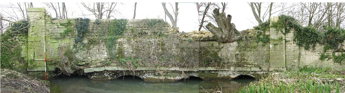
Photograph 4. A composite view of the East side of the Flood Relief aqueduct during the early stages of repair
viewed from the public footpath 17th March 2008. GP
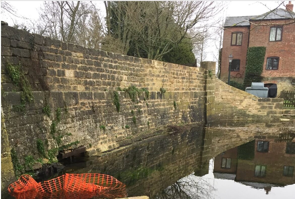
Photograph 5. The partly repaired East wall of the Flood Relief Aqueduct GK
Photograph 6. A composite photograph of the West wall of the Flood Relief Aqueduct before repair. GP
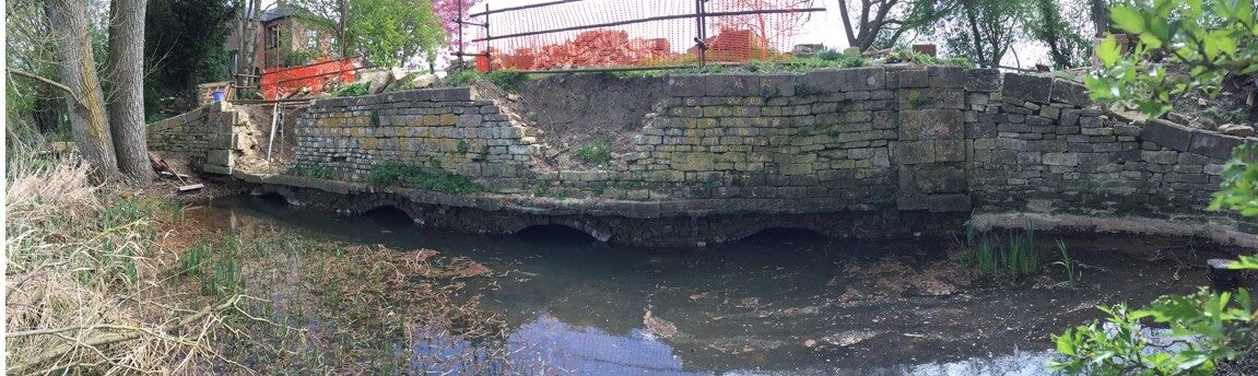
Photograph 7. The West wall of the Flood Relief Aqueduct after removal of the tree roots. GK
Photograph 8. Repairs to part of the West wall of the Flood Relief Aqueduct. GP
6. The Canal
OS Grid Reference 4086619528 To 4086619493
The canal is elevated above the surrounding land. Without an exploratory excavation, it appears to be formed by two parallel embankments which have then been lined with clay. This section of the canal is about 450m long. The bed of the canal has been cleared of overgrowth. This has facilitated the use of the footpath that runs along what was the towpath of the canal.
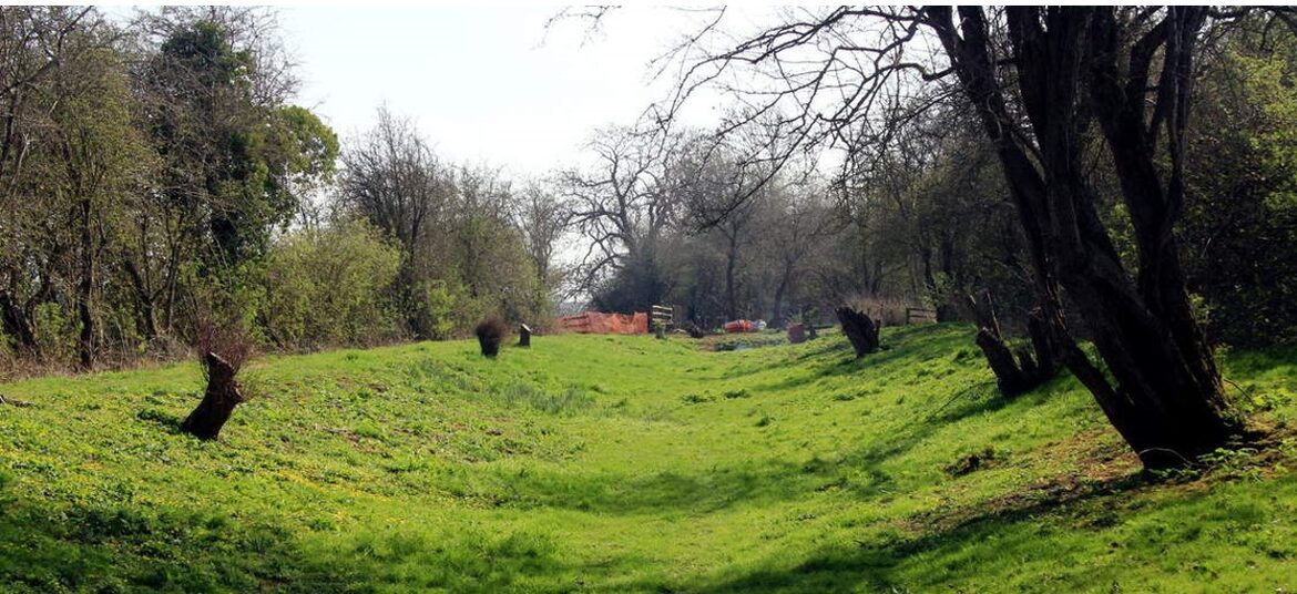
Photograph 9. The cleared canal bed. The public footpath is on the left and the footbridge
and site of the Southern Churn Aqueduct are in the background. DS
7. The Southern Churn Aqueduct
OS Grid Reference 4086619493
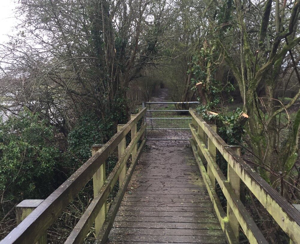
There are substantial remains of this aqueduct, although the centre section has been removed to allow a free passage for the river. The footpath crosses the river on a wooden bridge.
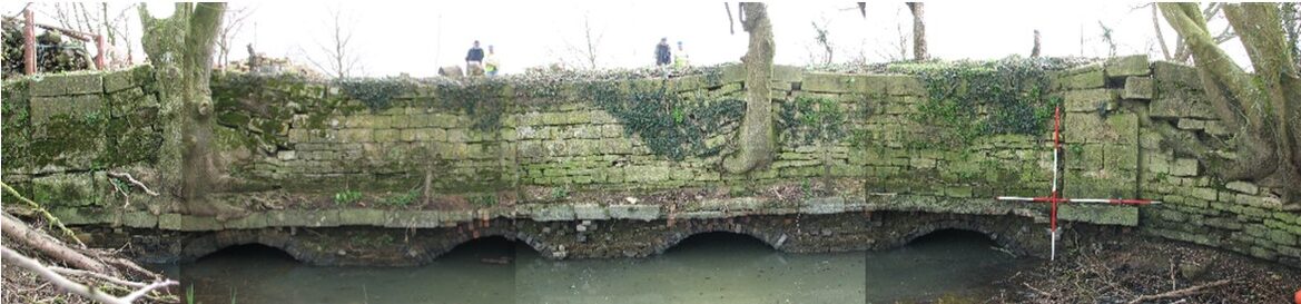
Investigations show that the four wing walls have survived to a greater or lesser extent. That on the North East corner is the most intact and two of the arches can be seen. Based on the dimensions of the site (about 35m long by 25m wide) and the spacing of the existing arches it is probable that there were a total of seven arches.
Some restoration of the North East wing wall has taken place.
Photograph 10. Part of the North East wing wall of the Southern Churn Aqueduct. One of the arches is visible. GK
8. The Canal
OS Grid Reference 4086619493 To 4087519475
This 200m section of the canal between the Rivers Churn and Thames is overgrown. The footpath can be difficult after wet weather.
Photograph 11. A view of the uncleared canal looking South across the River Churn footbridge GK
9. The Thames Aqueduct
OS Grid Reference 4087519475
Preliminary investigation of this area has not revealed any remains. Given the length, judged from single old photograph, this aqueduct would appear to have probably had four arches.
As at the Churn, the footpath now crosses the river Thames on a wooden bridge.
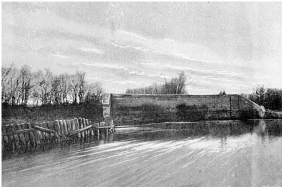
Photograph 12. An old photograph of the River Thames Aqueduct viewed from the East. Anon
Context and Conclusions
In Swindon most of the evidence of the North Wilts Canal has either been destroyed or built over. There is one remaining section which, together with a tunnel under the West of England main railway line, is used as a footpath and cycle way.
In the more rural parts, the Wilts & Berks Canal Trust have restored an aqueduct over the River. Ray and partly restored a lock at Moulden Hill Country Park. Another aqueduct has also been restored over the River Key just South of Cricklade.
In Cricklade the line of the canal has been built over by residential development and a former tunnel has been blocked.
The section of canal between the River Thames and its junction with the former Thames & Severn Canal and its associated structures is unique in the degree of preservation compared to the rest of the canal. The combination of structures may also be unique on the British canal network.
There is much investigation and recording which can be done to aid our understanding of the construction methods and operation of the canal network during the early nineteenth century. The object of this work would be to publish this information to the public realm to facilitate the public awareness of this important site and its influence on the history of the local area.
Acknowledgements
Thanks are due to the owner of the Lock Cottage, for access to his garden and to Gary Kenyon and Doug Small for the use of their photographs.
References
L.J.Dalby. 2000. “The Wilts and Berks Canal” The Oakwood Press 3rd Edition
Prepared by Graham Perry BSc DipHE
November 2020